The Wittenberg University campus is a beautiful, 100-acre property located just north across Buck Creek from downtown Springfield and the Springfield Regional Medical Center. The campus is bordered on the north by West McCreight Avenue, on the east by North Fountain Avenue, on the south by Buck Creek and Cliff Park Road, and on the west by North Plum Street. North Limestone Street (OH-72) runs north-south just east of campus, and US Routes 40/41 and State Route 4 run east-west just south of campus. Springfield is easily accessible from five different exits on I-70, about halfway between Dayton and Columbus. From I-70, signs for Wittenberg can be easily followed at Exit 62 for OH-40, or from US-68 at the exit for OH-41.
Health, Wellness & Athletics Complex
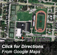 SPORTS: Basketball, Field Hockey, Football, Lacrosse, Soccer, Swimming & Diving, Tennis, Track & Field, Volleyball
FACILITIES: Pam Evans Smith Arena, Edwards-Maurer Field, Albright Tennis Complex, Natatorium, Earl F. Morris Track, Rosencrans Fitness Center, Golf Practice Rooms, Bates Strength Center, Kremchek Training Room
PARKING: Click here for parking information.
Address: 250 Bill Edwards Drive, Springfield, OH 45501
From the East on I-70
Take Exit 62 onto OH-40 (West) toward Springfield. Follow OH-40/41 into the downtown area. Turn right at North Fountain Avenue. You will pass the main entrance to campus on the left. Turn left at Bill Edwards Drive. After a stop sign, the front entrance of the HPER Center is at the top of the hill.
From the West on I-70
Take Exit 52B onto US-68 (North) toward Springfield. Take the OH-41 exit toward Springfield/Troy. From the ramp, turn right onto OH-41. When the road deadends, turn right onto St. Paris Pike. St. Paris Pike becomes West McCreight Avenue. In about a half mile, Edwards-Maurer Field will be visible on the right. Take the first right past the field onto Woodlawn Avenue. Turn right onto Bill Edwards Drive. The front entrance of the HWA Complex is at the top of the hill.
Carleton Davidson Stadium
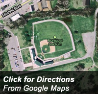 SPORTS: Baseball
FACILITIES: Carleton Davidson Stadium
PARKING: Click here for parking information.
Address: 1101 Mitchell Blvd., Springfield, OH 45503
From the East on I-70
Take Exit 62 onto OH-40 (West) toward Springfield. Follow OH-40/41 into the downtown area. Turn right at North Fountain Avenue. You will pass the main entrance to campus on the left. Turn right onto West McCreight Avenue. You will pass through a stoplight at North Limestone Street and follow McCreight around a sharp curve to the left. McCreight becomes Mitchell Boulevard. Look for a sign for Carleton Davidson Stadium on the left just down the hill. The entrance to the stadium is immediately opposite the sign, on the right side.
From the West on I-70
Take Exit 52B onto US-68 (North) toward Springfield. Take the OH-41 exit toward Springfield/Troy. From the ramp, turn right onto OH-41. When the road deadends, turn right onto St. Paris Pike. St. Paris Pike becomes West McCreight Avenue. After passing through a stoplight at North Limestone Street, follow McCreight around a sharp curve to the left. McCreight becomes Mitchell Boulevard. Look for a sign for Carleton Davidson Stadium on the left just down the hill. The entrance to the stadium is immediately opposite the sign, on the right side.
Betty Doughman Dillahunt Field
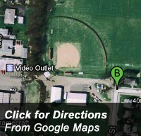 SPORTS: Softball
FACILITIES: Betty Doughman Dillahunt Field
PARKING: Click here for parking information.
Address: 1291 N. Yellow Springs St., Springfield, OH 45503
From the East on I-70
Take Exit 62 onto OH-40 (West) toward Springfield. Follow OH-40/41 into the downtown area. Turn right at North Fountain Avenue. You will pass the main entrance to campus on the left. Turn left onto West McCreight Avenue. Go through the stoplight at Plum Street and turn right onto North Yellow Springs Street, just past Malia Salon & Day Spa. There is a sign for Bill Edwards Field. Dillahunt Field is straight ahead, just past the intramural field.
From the West on I-70
Take Exit 52B onto US-68 (North) toward Springfield. Take the OH-41 exit toward Springfield/Troy. From the ramp, turn right onto OH-41. When the road deadends, turn right onto St. Paris Pike. St. Paris Pike becomes West McCreight Avenue. After the bend, take the first left onto North Yellow Springs Street, where there is a sign for Bill Edwards Field. Dillahunt Field is straight ahead, past the intramural field.
Springfield Country Club
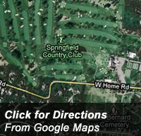 SPORTS: Golf
Address: 2315 Signal Hill Rd., Springfield, OH 45504
From the East on I-70
Take Exit 62 onto OH-40 (West) toward Springfield. Follow OH-40/41 into the downtown area. Turn right at North Fountain Avenue. You will pass the main entrance to campus on the left and then through a stoplight at West McCreight Avenue. Follow North Fountain Avenue until it ends at Home Road. The entrance to the country club is straight through the stop sign.
From the West on I-70
Take Exit 52B onto US-68 (North) toward Springfield. Take the OH-41 exit toward Springfield/Troy. From the ramp, turn right onto OH-41. When the road deadends, turn right onto St. Paris Pike. St. Paris Pike becomes West McCreight Avenue. Turn left onto North Fountain Avenue. Follow North Fountain Avenue until it ends at Home Road. The entrance to the country club is straight through the stop sign.